By Daniel Hayes
American farmers, ranchers, and agricultural analysts will gain faster access to orbital soil moisture, crop health, and drought datasets under an expanded federal research partnership. Signed on October 24, 2026, the agreement integrates advanced satellite Earth observation and geospatial computing directly into national agricultural data modernization programs.
U.S. Secretary of Agriculture Brooke Rollins and space agency Administrator Jared Isaacman signed the Memorandum of Understanding on Saturday, October 24, during an outreach event at the University of Alabama in Tuscaloosa. The pact deepens a longstanding interagency partnership by connecting spaceborne sensing instruments directly with the Department of Agriculture’s data modernization plan for United States farmland and rangelands.
Modern agricultural producers contend with shifting seasonal rainfall, regional heat waves, and severe weather events that can alter harvest outlooks within days. By combining orbital remote sensing with ground-level agricultural expertise, the two federal agencies aim to deliver more timely, high-resolution crop and environmental information to farmers, ranchers, and policymakers.
Integrating Geospatial Analytics and Remote Sensing
Under the October 2026 agreement, technical teams will expand collaborative work across five core disciplines: agricultural statistics, remote sensing science, environmental modeling, geospatial data engineering, and advanced high-performance computing. These combined analytical capabilities are designed to translate massive orbital datasets into practical, field-level decision tools.
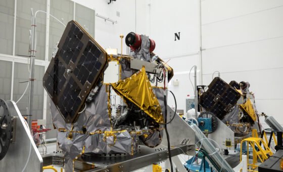
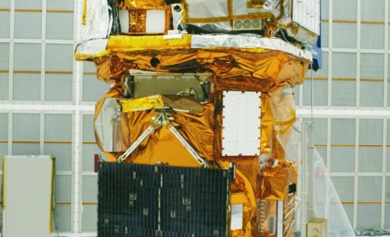
Continuous satellite Earth observation enables researchers to detect subtle changes in plant canopy temperatures, chlorophyll fluorescence, and root-zone soil moisture weeks before visible wilting appears on the ground. Optical, thermal infrared, and L-band and S-band synthetic aperture radar instruments in low Earth orbit can monitor vegetation structure and surface moisture day and night regardless of cloud cover.
Aligning those orbital measurements with Department of Agriculture statistical models will sharpen national acreage and crop yield estimations throughout the planting and harvesting seasons. More reliable production estimates help stabilize agricultural supply chains, guide precision irrigation and fertilizer application, and strengthen farm profitability across rural regions.
Strengthening Drought and Natural Hazard Assessments
Beyond routine crop monitoring, the expanded partnership prioritizes rapid assessment of natural hazards, including prolonged droughts, river flooding, unseasonal freezes, and wildfire smoke impacts. When severe weather strikes an agricultural basin, spaceborne sensors provide immediate before-and-after maps of affected croplands, orchards, and grazing pastures to accelerate disaster response.
Orbital missions already operating in low Earth orbit, including thermal radiometers mounted on the International Space Station, Landsat multispectral imagers, and dual-frequency radar satellites scanning land surfaces every 12 days, provide foundational measurements for the initiative. Combining those spaceborne observations with county-level soil and weather station networks allows analysts to track water stress and crop development down to individual agricultural districts.
Isaacman stated that putting advanced sensing, computing, and analytical tools to work for domestic agriculture delivers meaningful economic outcomes while advancing high-reward scientific research. Rollins noted that leveraging space technology and research will modernize acreage and yield forecasting and drive long-term competitiveness for American producers.
In the coming months, the two federal organizations will also design and test new cloud-based software architectures for managing and analyzing multi-terabyte geospatial archives across federal cloud systems. As environmental monitoring and applied Science converge, Earth-observing satellites will continue turning continuous orbital measurements into more resilient food and fiber production on the ground.